|
| at: |
Lake Conasauga Recreation Area |
Data from David Muse
 show on map
 animate
Trail users:


Elevation Profile
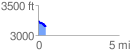
 0.499464 mi
 43.58 ft
 142.92 ft
 -99.34 ft
 5.42 %
GPX Downloads: Track Route
![]()
|
| at: |
Lake Conasauga Recreation Area |
show on map
animate
0.499464 mi
43.58 ft
142.92 ft
-99.34 ft
5.42 %