|
| at: |
Lake Burton WMA |
Data from David Muse
 show on map
 animate
Trail users:


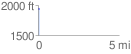
Elevation Profile
 0.091029 mi
 18.78 ft
 0.00 ft
 18.78 ft
 3.91 %
GPX Downloads: Track Route
![]()
|
| at: |
Lake Burton WMA |
show on map
animate
0.091029 mi
18.78 ft
0.00 ft
18.78 ft
3.91 %