| at: |
Fort Ord Public Lands |
Data from Jason Sager
 show on map
 animate
Trail users:


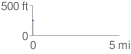
Elevation Profile
 0.072532 mi
 6.86 ft
 11.81 ft
 -4.95 ft
 3.08 %
GPX Downloads: Track Route
![]()
| at: |
Fort Ord Public Lands |
show on map
animate
0.072532 mi
6.86 ft
11.81 ft
-4.95 ft
3.08 %