|
| at: |
Fort Ord Public Lands |
Data from Jason Sager
 show on map
 animate
Trail users:


Elevation Profile
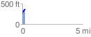
 0.263624 mi
 112.72 ft
 0.00 ft
 112.72 ft
 8.10 %
GPX Downloads: Track Route
![]()
|
| at: |
Fort Ord Public Lands |
show on map
animate
0.263624 mi
112.72 ft
0.00 ft
112.72 ft
8.10 %