| at: |
Fort Ord Public Lands |
Data from David Muse
 show on map
 animate
Trail users:


Elevation Profile
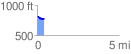
 0.421376 mi
 24.28 ft
 50.74 ft
 -26.47 ft
 2.28 %
GPX Downloads: Track Route
![]()
| at: |
Fort Ord Public Lands |
show on map
animate
0.421376 mi
24.28 ft
50.74 ft
-26.47 ft
2.28 %