| at: |
Forks Area Trail System Sumter National Forest - Long Cane District |
Data from David Muse
 show on map
 animate
Trail users:


Elevation Profile
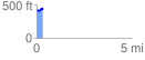
 0.317357 mi
 41.29 ft
 48.34 ft
 -7.05 ft
 2.88 %
GPX Downloads: Track Route
![]()
| at: |
Forks Area Trail System Sumter National Forest - Long Cane District |
show on map
animate
0.317357 mi
41.29 ft
48.34 ft
-7.05 ft
2.88 %