| at: |
Frank G. Bonelli Regional Park |
Data from David Muse
 show on map
 animate
Trail users:


Elevation Profile
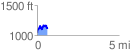
 0.622167 mi
 215.69 ft
 149.20 ft
 66.48 ft
 6.57 %
GPX Downloads: Track Route
![]()
| at: |
Frank G. Bonelli Regional Park |
show on map
animate
0.622167 mi
215.69 ft
149.20 ft
66.48 ft
6.57 %