|
| at: |
Houston Valley |
Data from USFS GIS
 show on map
 animate
Trail users:


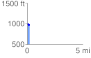
Elevation Profile
 0.236283 mi
 48.73 ft
 47.65 ft
 1.08 ft
 3.91 %
GPX Downloads: Track Route
![]()
|
| at: |
Houston Valley |
show on map
animate
0.236283 mi
48.73 ft
47.65 ft
1.08 ft
3.91 %