|
| at: |
Beasley Knob |
Data from USFS GIS
 show on map
 animate
Trail users:


Elevation Profile
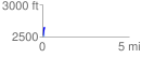
 0.132517 mi
 131.91 ft
 1.08 ft
 130.82 ft
 18.85 %
GPX Downloads: Track Route
![]()
|
| at: |
Beasley Knob |
show on map
animate
0.132517 mi
131.91 ft
1.08 ft
130.82 ft
18.85 %