| at: |
Lake Winfield Scott |
Data from USFS GIS
 show on map
 animate
Trail users:

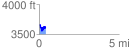
Elevation Profile
 0.408201 mi
 120.37 ft
 166.80 ft
 -46.43 ft
 7.74 %
GPX Downloads: Track Route
![]()
| at: |
Lake Winfield Scott |
show on map
animate
0.408201 mi
120.37 ft
166.80 ft
-46.43 ft
7.74 %