| at: |
Panther Creek |
Data from USFS GIS
 show on map
 animate
Trail users:

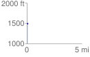
Elevation Profile
 0.094907 mi
 30.41 ft
 21.05 ft
 9.36 ft
 6.07 %
GPX Downloads: Track Route
![]()
| at: |
Panther Creek |
show on map
animate
0.094907 mi
30.41 ft
21.05 ft
9.36 ft
6.07 %