|
| at: |
Locust Stake |
Data from USFS GIS
 show on map
 animate
Trail users:


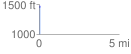
Elevation Profile
 0.057048 mi
 16.91 ft
 18.89 ft
 -1.98 ft
 6.27 %
GPX Downloads: Track Route
![]()
|
| at: |
Locust Stake |
show on map
animate
0.057048 mi
16.91 ft
18.89 ft
-1.98 ft
6.27 %