| at: |
Lake Conasauga Recreation Area |
Data from USFS GIS
 show on map
 animate
Trail users:

Elevation Profile
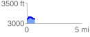
 0.730923 mi
 174.58 ft
 157.94 ft
 16.64 ft
 4.52 %
GPX Downloads: Track Route
![]()
| at: |
Lake Conasauga Recreation Area |
show on map
animate
0.730923 mi
174.58 ft
157.94 ft
16.64 ft
4.52 %