| at: |
South Oconee National Forest |
Data from USFS GIS
 show on map
 animate
Trail users:

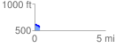
Elevation Profile
 0.359590 mi
 14.14 ft
 55.21 ft
 -41.07 ft
 2.91 %
GPX Downloads: Track Route
![]()
| at: |
South Oconee National Forest |
show on map
animate
0.359590 mi
14.14 ft
55.21 ft
-41.07 ft
2.91 %