| at: |
Oakey Mountain |
Data from USFS GIS
 show on map
 animate
Trail users:

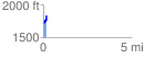
Elevation Profile
 0.189229 mi
 142.59 ft
 25.05 ft
 117.54 ft
 14.27 %
GPX Downloads: Track Route
![]()
| at: |
Oakey Mountain |
show on map
animate
0.189229 mi
142.59 ft
25.05 ft
117.54 ft
14.27 %