| at: |
Lawrence Shoals Recreation Area |
Data from David Muse
 show on map
 animate
Trail users:


Elevation Profile
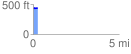
 0.265278 mi
 8.39 ft
 8.03 ft
 0.36 ft
 0.60 %
GPX Downloads: Track Route
![]()
| at: |
Lawrence Shoals Recreation Area |
show on map
animate
0.265278 mi
8.39 ft
8.03 ft
0.36 ft
0.60 %