| at: |
Breckenridge |
Data from Positive Flow
 show on map
 animate
Trail users:


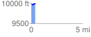
Elevation Profile
 0.369617 mi
 50.73 ft
 32.62 ft
 18.12 ft
 2.60 %
GPX Downloads: Track Route
![]()
| at: |
Breckenridge |
show on map
animate
0.369617 mi
50.73 ft
32.62 ft
18.12 ft
2.60 %