| at: |
Breckenridge |
Data from Positive Flow
 show on map
 animate
Trail users:


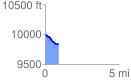
Elevation Profile
 0.911216 mi
 5.58 ft
 164.76 ft
 -159.19 ft
 3.42 %
GPX Downloads: Track Route
![]()
| at: |
Breckenridge |
show on map
animate
0.911216 mi
5.58 ft
164.76 ft
-159.19 ft
3.42 %