| at: |
Tom Triplett Community Park |
Data from Positive Flow
 show on map
 animate
Trail users:


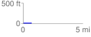
Elevation Profile
 0.729045 mi
 8.20 ft
 5.30 ft
 2.90 ft
 0.21 %
GPX Downloads: Track Route
![]()
| at: |
Tom Triplett Community Park |
show on map
animate
0.729045 mi
8.20 ft
5.30 ft
2.90 ft
0.21 %