|
| in: |
Atlanta Metro Area |
near: |
Woodstock,
Georgia |
 show on map
 printable map
Last Trail Update: 2019-05-17
printable map
Last Trail Update: 2019-05-17
Hours:
24/7
Status Hotline:
678-568-1508
Status Website:
http://www.sorbawoodstock.org/
Maps:
Links:
Welcome to the Woodstock Chapter of SORBA
Routes:
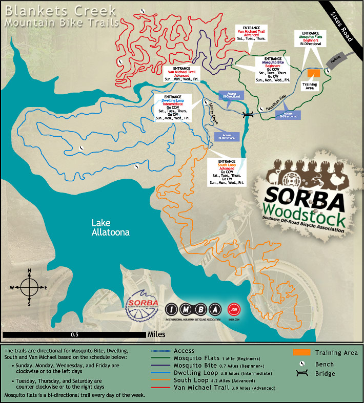
Blankets Creek Beginner Loop - 1.55 mi
Blankets Creek Expert Loop - 12.77 mi
Blankets Creek Intermediate Loop - 5.14 mi
Trailheads:
 Blankets Creek
Total Mileage: (note)
 Bike Trail - 15.94 mi Dirt/Gravel Road - 0.05 mi
Trails:
420 Climb - 0.11 mi Chutes and Ladders - 0.13 mi Dwelling Charlie Bear Trail - 0.32 mi Dwelling-South Loop Connector - 0.09 mi Dwelling Trail - 3.97 mi Dwelling Trail Alternate - 0.13 mi Dwelling Trail Easier Option 1 - 0.19 mi Dwelling Trail Easier Option 2 - 0.05 mi Dwelling Trail Easier Option 3 - 0.03 mi Dwelling Trail Easier Option 4 - 0.01 mi Dwelling Trail Shortcut - 0.07 mi Hamiltons Hop - 0.53 mi Kevorkian Pass - 0.39 mi Mosquito Bite - 0.58 mi Mosquito Flats Extension - 0.31 mi | AKA: |
9th Ward |
Mosquito Flats (North Side) - 0.51 mi Mosquito Flats (South Side) - 0.35 mi New Jump Line (Unfinished) - 0.13 mi Rhythm and Blues - 0.37 mi | AKA: |
Stewart's Shock and Rock |
Rock and Roll - 0.34 mi | AKA: |
Flow Trail |
Schultz's Chute - 0.22 mi South Loop - 3.59 mi South Loop Connector - 0.42 mi South Loop Shortcut - 0.04 mi The Holler - 0.20 mi | AKA: |
Quell Holler |
Van Michael Loop - 2.83 mi Van Michael Shortcut - 0.01 mi Roads:
Blankets Creek Lot Center - 0.05 mi Bells Ferry Road (Sixes to Canton) - 3.88 mi Blankets Creek Lot - 0.18 mi Butterworth Road - 1.67 mi Cherokee Aquatic Center Lot - 0.35 mi Copper Creek Drive - 1.18 mi (Residential)Diamond Ridge Ave - 0.61 mi Gresham Mill Parkway - 0.62 mi Holly Street - 2.95 mi Keeter Drive - 1.50 mi Ridge Road - 3.82 mi Sixes Road - 3.56 mi Points of Interest:
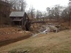
 Gresham Mill