|
| in: |
Bartow County Area |
near: |
White,
Georgia |
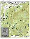
 show on map
 printable map
Last Trail Update: 2021-06-13
printable map
Last Trail Update: 2021-06-13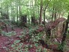


Maps:
Links:
A Preliminary Report on a Part of the Iron Ores of Georgia: Polk, Bartow and Floyd Counties, Issue 10
Geology and Mineral Deposits of the Cartersville District, Georgia
Iron Ore Deposits of Georgia
Report on the Mining Industries of the United States (exclusive of the Precious Metals): With Special Investigations Into the Ir
Sugar Hill - Etowah Valley Historical Society
The iron manufacturer's guide to the furnaces, forges and rolling mills of the United States: With maps and plates
Trailheads:
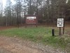
 Pine Log Parking LotPine Log Parking Lot (North)
Total Mileage: (note)
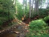
 Bike/Horse Trail - 0.50 mi Dirt/Gravel Road - 23.90 mi
Trails:
Poplar Pit Road Spur (Doubletrack) - 0.22 mi Shut-In Ridge Connector (North) - 0.28 mi Roads:
Donahue Road - 0.97 mi Donahue Road (Gated) - 2.23 mi | AKA: |
Gate 5 Road |
Dove Field Road - 0.72 mi Grassy Hollow Loop - 7.87 mi | AKA: |
Main Road Cotton Patch Road |
Handicapped Access Road - 0.05 mi Main Road Campsite Spur 3 - 0.08 mi Oak Street (Unpaved) - 3.06 mi Pine Log Game Check Station Lot - 0.05 mi Pine Log Gap Road - 7.16 mi Pine Log Parking Lot - 0.10 mi Poplar Pit Road - 1.38 mi | AKA: |
Rock Quarry Road |
Poplar Pit Road Spur - 0.24 mi Administration Office Road - 0.42 mi Bells Ferry Road - 3.63 mi Brooke Road - 1.05 mi East Valley Road - 5.40 mi Falling Springs Road - 1.08 mi Hwy 108 (Sutallee to Waleska) - 9.82 mi Hwy 140 (Waleska to Rydal) - 11.36 mi Hwy 20 (Canton to Hwy 75) - 16.51 mi Hwy 411 (White to Rydal) - 4.88 mi Landers Road - 0.91 mi Little Refuge Road - 5.35 mi Mt. Carmel Church Lane - 1.92 mi Oak Street (Paved) - 0.15 mi Old Tennessee Road - 6.34 mi Richards Road - 0.40 mi Scott Hudgens Drive - 2.71 mi Stamp Creek Road - 6.56 mi Sugar Hill Road (Section 1) - 1.00 mi Sugar Hill Road (Section 2) - 0.05 mi Vaughn Dairy Road - 1.37 mi White Road - 2.55 mi Points of Interest:
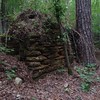
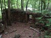
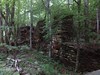
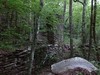
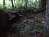
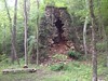
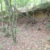
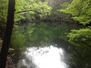
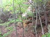
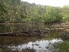
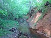
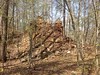
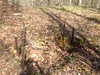
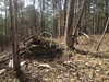
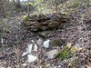
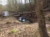
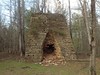
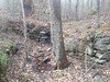
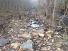
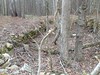
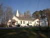
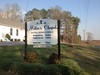
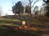
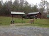
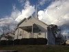
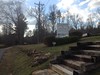
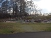
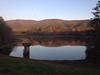
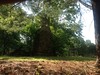
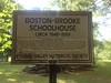
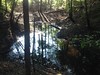
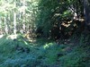
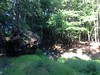
 Neel LakePine Log Game Check StationStamp Creek Church and CemeteryMillers ChapelGeorgia National CemeteryMt. Carmel Baptist ChurchPeachtree Ore BankSugar Hill Iron Mine - Pine Hill Cut / Sugar Hill PondLewis Iron Blast FurnaceOre Banks Along Little Pine Log MountainUnion Iron Blast FurnaceLower Sugar Hill Creek Dam RuinsSugar Hill Iron Mine - Cripple Creek Ore Bank PondSugar Hill Iron Mine - Bluff Mine PondSugar Hill Iron Mine - Unnamed CutConner Ore BankSugar Hill Iron Mine - Sugar Hill CutUpper Sugar Hill Creek Dam RuinsJones Mill RuinsBoston-Brooke Schoolhouse RuinsSugar Hill Iron Mine - Kinsey CutPool Iron Blast Furnace