| at: |
Bear Creek/Mountaintown Windy Gap |
Data from David Muse
 show on map
 animate
Route users:

Elevation Profile
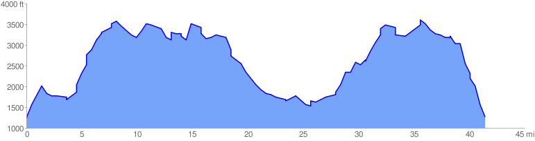
 42.085307 mi
 8920.86 ft
 8920.86 ft
 0.00 ft
GPX Downloads: Track Route
![]()
| at: |
Bear Creek/Mountaintown Windy Gap |
show on map
animate
42.085307 mi
8920.86 ft
8920.86 ft
0.00 ft