| at: |
Mulberry Gap |
Data from David Muse
 show on map
 animate
Route users:
Elevation Profile
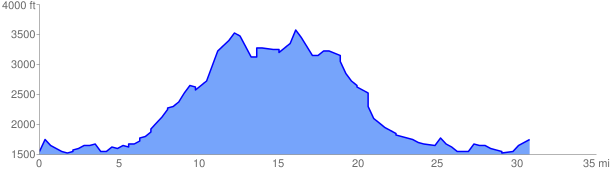
 31.225861 mi
 5935.76 ft
 5935.76 ft
 0.00 ft
GPX Downloads: Track Route
![]()
| at: |
Mulberry Gap |
show on map
animate
31.225861 mi
5935.76 ft
5935.76 ft
0.00 ft