| in: |
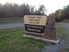
Chattahoochee National Forest - Conasauga Ranger District |
near: |
Ellijay,
Georgia |
 show on map
 printable map
Last Trail Update: 2019-11-30
printable map
Last Trail Update: 2019-11-30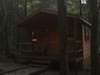
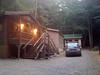

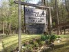
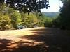


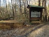
Located in the Cohutta Mountains of Gilmer County Georgia, The Mulberry Gap Mountain Bike Get-A-Way is a popular starting point for weekend trips as well as many organized rides. There are hundreds of miles of trail nearby and several popular routes.
Address:400 Mulberry Gap Road
Ellijay, GA 30540
866-635-1740
Ellijay, GA 30540
866-635-1740
Links:
Mulberry Gap Mountain Bike Get-A-Way
Routes:
2010 Drama Queen (Long Option) - 51.46 mi
2010 Drama Queen (Short Option) - 35.76 mi
Mulberry Gap - Bear Creek Loop - 22.42 mi
Mulberry Gap - Bear Creek/Mountaintown - 31.23 mi
Mulberry Gap - Bear Creek, P1 and P2 - 18.36 mi
Mulberry Gap - Bear Creek, P1, P2 and P3 - 25.80 mi
Mulberry Gap - Ellijay Bigger Loop - 50.59 mi
Mulberry Gap - Ellijay Big Loop - 43.70 mi
Mulberry Gap - Ellijay Short Loop - 30.14 mi
Mulberry Gap - P1 and P2 - 16.23 mi
Mulberry Gap - P1, P2, and P3 - 23.67 mi
Mulberry Gap - P3, P4, P5 and Rock Creek - 23.55 mi
Mulberry Gap - Potatopatch - 12.23 mi
Mulberry Gap - Potatopatch via Bear Creek - 24.34 mi
Mulberry Gap - Short Gravel Loop - 8.52 mi
Mulberry Gap - Windy Gap - 24.09 mi
Mulberry Gap - Windy Gap, Milma and Tibbs - 28.57 mi
Tour De Liverance - 105 mile option - 105.26 mi
Trailheads:
 Bear Creek Lower Parking LotBear Creek Upper Parking LotPinhoti - Dennis Mill Parking LotPinhoti - FS90B Parking LotRock Creek ORV Parking LotTibbs LotUpper Mountaintown CreekWindy Gap Parking Lot
Total Mileage: (note)
 Hiking Trail - 1.33 mi Bike Trail - 21.16 mi Bike/Horse Trail - 3.10 mi Motor Vehicle/Bike Trail - 19.93 mi Dirt/Gravel Road - 39.79 mi
Trails:
Bear Creek/Mountaintown Connector - 1.33 mi Bear Creek Spur - 0.30 mi | AKA: |
Bear Creek Switchbacks |
Bear Creek Trail - 2.40 mi Mountaintown Creek Trail - 5.57 mi Mulberry Gap Trail - 0.56 mi (Private) Pinhoti 1 - 3.71 mi Pinhoti 2 - 1.98 mi Pinhoti 3 - 3.72 mi Pinhoti 4 Trail - 0.74 mi Pinhoti 5 - 2.19 mi Old FS3A (Doubletrack) - 0.61 mi Pinhoti 6 - 2.48 mi FS78 - 2.28 mi | AKA: |
Tibbs |
FS78B - 3.91 mi | AKA: |
Milma Creek Road |
Rock Creek ORV Trail (Northern Branch) - 1.35 mi Rock Creek ORV Trail (Southern Branch) - 2.67 mi Tatum Lead Road 4WD Trail - 5.69 mi | AKA: |
Old FS631 |
Windy Gap Cycle Trail - 4.03 mi Roads:
FS18 - 7.49 mi | AKA: |
Conasauga Road Mulberry Gap Road Old CCC Camp Road Holly Creek Road |
FS218 - 5.12 mi | AKA: |
Muskrat Creek Road |
FS3 - 5.18 mi | AKA: |
Rock Creek Road FS10 Peeples Road |
FS3A - 2.05 mi FS3A (Grasstrack) - 3.21 mi FS68 - 11.71 mi | AKA: |
Conasauga Lake Road Potato Patch Road |
FS90 - 1.66 mi | AKA: |
Barnes Creek Road |
FS90B - 0.51 mi | AKA: |
Stillhouse Road FS90A |
FS90B (Grasstrack) - 1.58 mi Mulberry Gap Drive - 0.12 mi (Private) Pinhoti 4 Roadbed - 0.30 mi Tatum Lead Road - 0.86 mi | AKA: |
Old FS631 Tatum Mountain Road |
CCC Camp Road - 6.10 mi Mulberry Gap Loop - 0.20 mi (Private) Points of Interest:
 Mulberry Gap Mountain Bike Getaway