| at: |
West Georgia Pinhoti Trans North Georgia Johns Mountain WMA Dry Creek |
Data from David Muse
 show on map
 animate
Trail users:


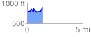
Elevation Profile
 1.404544 mi
 255.98 ft
 148.54 ft
 107.45 ft
 3.45 %
GPX Downloads: Track Route
Trailheads:
 Dry Creek LotPinhoti - East Amurchee Road Parking Area