| in: |
Chattahoochee National Forest - Conasauga Ranger District Northwest Georgia |
near: |
Dalton,
Georgia |
 show on map
 printable map
Last Trail Update: 2022-12-26
printable map
Last Trail Update: 2022-12-26

Hours:
24/7 except during organized hunts, use caution and courtesy during hunting season
Routes:
Snake Creek Gap Time Trial 17 Miler - 16.88 mi
Snake Creek Gap Time Trial 32 Miler - 31.60 mi
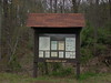
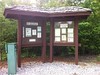
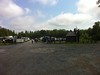
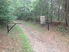
Trailheads:
 Dry Creek LotPinhoti - Dug Gap Battlefield Parking AreaPinhoti - East Amurchee Road Parking AreaPinhoti - High Point Parking LotPinhoti - Mack White Gap Parking LotPinhoti - Simms MountainPinhoti - Snake Creek Gap Parking LotPinhoti - Starling Mill Parking LotPinhoti - The Narrows
Total Mileage: (note)
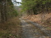
 Paved Trail - 0.09 mi Hiking Trail - 2.44 mi Bike/Horse Trail - 60.45 mi Dirt/Gravel Road - 62.08 mi
Trails:
Trail to Cave Spring - 0.09 mi Pinhoti Trail (Old Jackson Chapel Road to Alabama Border) - 2.44 mi FS310 (Doubletrack) - 1.85 mi | AKA: |
East Amurchee Creek Road |
Old FS227A - 0.33 mi | AKA: |
Manning Mill Branch A |
Old FS270 - 0.85 mi Pinhoti (Along Hwy 100) - 8.34 mi Pinhoti (Dug Mountain to Middle Mountain) - 7.61 mi Pinhoti (FS201 to Hwy 100) - 1.84 mi Pinhoti (FS205A to FS201) - 4.42 mi Pinhoti (FS208 to FS310) - 2.51 mi Pinhoti (FS227 to FS227A) - 0.41 mi Pinhoti (FS254 to Mack White Gap) - 0.60 mi Pinhoti (FS259 cutoff) - 2.72 mi Pinhoti (FS259/FS254 Connector) - 1.50 mi Pinhoti (FS310 to Old FS270) - 1.40 mi Pinhoti (Narrows Picnic Area to Hammond Gap) - 0.87 mi Pinhoti (Old FS359) - 1.20 mi Pinhoti (Pilcher Pond Connector) - 0.54 mi Pinhoti (Pocket Road to Old FS359) - 0.35 mi Pinhoti (Snake Creek Gap to Pocket Road) - 5.47 mi Pinhoti (Strawberry Mountain) - 1.28 mi Pinhoti (Swamp Creek to Snake Creek Gap) - 6.24 mi Pinhoti Trail (Cave Spring Road to Old Jackson Chapel Road) - 5.81 mi Simms Mountain Trail - 4.30 mi Roads:
Esom Hill Road - 4.68 mi FS201 (Unpaved) - 4.01 mi FS202 - 0.64 mi | AKA: |
Beacon Road |
FS205 - 4.76 mi | AKA: |
South Taylor Ridge Road |
FS205A - 0.45 mi | AKA: |
Mack White Gap Road |
FS207A - 2.47 mi | AKA: |
Stover Creek Road A |
FS208 - 2.17 mi | AKA: |
Johns Mountain Overlook Road |
FS227 - 3.92 mi | AKA: |
Manning Mill Road |
FS227A - 1.15 mi | AKA: |
Manning Mill Branch A |
FS228 - 1.18 mi | AKA: |
Neal Road |
FS252 - 7.80 mi | AKA: |
Ruff Creek Road |
FS254 - 3.50 mi | AKA: |
Taylors Ridge |
FS255 - 0.93 mi | AKA: |
Dry Slough Road |
FS257 - 2.04 mi | AKA: |
Ridge Road |
FS259 - 10.17 mi | AKA: |
Hammond Gap Road |
FS269 - 1.66 mi | AKA: |
Strawberry West Road |
FS310 - 1.32 mi | AKA: |
East Amurchee Creek Road |
FS347 - 1.15 mi | AKA: |
Sloppy Floyd Lake Road Marble Springs Road |
FS635B - 1.25 mi | AKA: |
Smith Gap Br. B |
M. C. Beck Road - 2.60 mi Old FS227A (Unexplored) - 0.05 mi | AKA: |
Manning Mill Branch A |
Old Jackson Chapel Road (Section 1) - 1.17 mi Pinhoti FS259/FS254 Connector (Old Roadbed) - 0.99 mi Pinhoti - High Point Parking Lot - 0.14 mi Pinhoti - Mack White Gap Parking Lot - 0.02 mi Santa Claus Road (Unpaved) - 1.88 mi Alabama Street - 0.27 mi Big Texas Valley Road - 13.80 mi Blacks Bluff Road (Hwy 1 to Hwy 100) - 4.79 mi Cave Springs Road - 9.55 mi Dug Gap Road - 3.97 mi East Amurchee Road - 9.93 mi Friday Road - 2.64 mi FS201 (Paved) - 1.09 mi Gore-Subligna Road - 8.23 mi Huffaker Road - 9.48 mi Hwy 100 - 8.41 mi | AKA: |
Mountain Home Road |
Hwy 100 (Summerville to Hwy 20) - 16.59 mi Hwy 136 (Villanow to Resaca) - 14.95 mi Hwy 1 (Hwy 20 to Blacks Bluff Road) - 5.49 mi Hwy 1 (Northbound Exit) - 0.57 mi Hwy 1 (Southbound Exit) - 0.27 mi Hwy 20 (Huffaker to Alabama) - 7.33 mi Hwy 20 (West Rome to Huffaker) - 6.81 mi Hwy 278 (Esom Hill Area) - 0.23 mi Hwy 27 (Gore to Summerville) - 5.42 mi John Jones Road - 2.99 mi Lick Skillet Road - 2.86 mi Lumpkin Road - 0.18 mi Manning Mill Road - 0.87 mi Manning Mill Road (Unexplored) - 2.74 mi Marble Springs Road - 0.98 mi | AKA: |
Pump Road |
Mills Road - 1.63 mi Mill Street - 1.17 mi Narrows Picnic Road - 1.72 mi Padlock Mountain Road - 0.11 mi Pearson Road - 0.84 mi Pocket Road - 7.03 mi Poplar Springs Road - 1.59 mi Rolater Drive - 0.26 mi Santa Claus Road (Paved) - 1.06 mi Silver Hill Road - 8.84 mi Sloppy Floyd Lake Road - 4.18 mi Spout Springs Road - 3.61 mi Starling Mill Road - 2.08 mi West Amurchee Road - 9.45 mi Points of Interest:
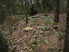
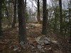
 Pit Mines