| at: |
Clemson Experimental Forest |
Data from Positive Flow
 show on map
 animate
Trail users:


Elevation Profile
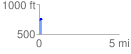
 0.161976 mi
 39.57 ft
 4.76 ft
 34.81 ft
 4.63 %
GPX Downloads: Track Route
![]()
| at: |
Clemson Experimental Forest |
show on map
animate
0.161976 mi
39.57 ft
4.76 ft
34.81 ft
4.63 %