| at: |
Bent Creek |
Data from David Muse
 show on map
 animate
Trail users:


Elevation Profile
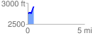
 0.522483 mi
 229.66 ft
 80.95 ft
 148.71 ft
 8.32 %
GPX Downloads: Track Route
![]()
| at: |
Bent Creek |
show on map
animate
0.522483 mi
229.66 ft
80.95 ft
148.71 ft
8.32 %