| at: |
James H. Floyd State Park |
Data from David Muse
 show on map
 animate
Trail users:


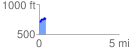
Elevation Profile
 0.402593 mi
 88.59 ft
 57.42 ft
 31.17 ft
 4.17 %
GPX Downloads: Track Route
![]()
| at: |
James H. Floyd State Park |
show on map
animate
0.402593 mi
88.59 ft
57.42 ft
31.17 ft
4.17 %