| at: |
James H. Floyd State Park |
Data from David Muse
 show on map
 animate
Trail users:

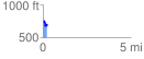
Elevation Profile
 0.206766 mi
 72.50 ft
 84.97 ft
 -12.47 ft
 7.78 %
GPX Downloads: Track Route
![]()
| at: |
James H. Floyd State Park |
show on map
animate
0.206766 mi
72.50 ft
84.97 ft
-12.47 ft
7.78 %