| at: |
Dawson Forest |
Data from David Muse
 show on map
 animate
Trail users:


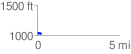
Elevation Profile
 0.278147 mi
 16.57 ft
 17.97 ft
 -1.40 ft
 1.22 %
GPX Downloads: Track Route
![]()
| at: |
Dawson Forest |
show on map
animate
0.278147 mi
16.57 ft
17.97 ft
-1.40 ft
1.22 %