| at: |
Camp Thunder |
Data from Dean Thornton
 show on map
 animate
Trail users:


Elevation Profile
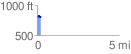
 0.231904 mi
 42.37 ft
 31.44 ft
 10.93 ft
 3.46 %
GPX Downloads: Track Route
![]()
| at: |
Camp Thunder |
show on map
animate
0.231904 mi
42.37 ft
31.44 ft
10.93 ft
3.46 %