| at: |
Santos |
Data from USFS GIS
 show on map
 animate
Trail users:


Elevation Profile
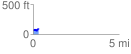
 0.331682 mi
 79.71 ft
 60.06 ft
 19.65 ft
 4.55 %
GPX Downloads: Track Route
![]()
| at: |
Santos |
show on map
animate
0.331682 mi
79.71 ft
60.06 ft
19.65 ft
4.55 %