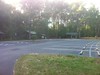
| in: |
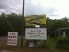
Central Florida |
near: |
Ocala,
Florida |
 show on map
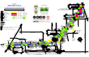
 printable map
Last Trail Update: 2021-12-06
printable map
Last Trail Update: 2021-12-06
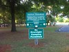
Hours:
Dawn to Dusk
Status Hotline:
(352) 369-2693
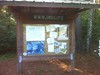
Maps:
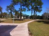
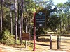
Trailheads:
 49th AvenueLand BridgeRoss PrairieSantosVortex
Total Mileage: (note)
 Bike Trail - 62.89 mi Bike/Horse Trail - 9.37 mi
Trails:
Anthill - 0.24 mi Backdoor - 0.17 mi Barns Landbridge TH Spur - 0.24 mi Barns North - 1.70 mi Barns South - 1.78 mi Beyond Trail - 2.73 mi Blu HiWay - 0.37 mi Bunny - 1.27 mi Canal Diggings - 0.88 mi Canopy - 0.39 mi Christmas - 2.95 mi Cowbone - 1.09 mi Coyote Corner North - 0.78 mi Coyote Corner South - 0.61 mi Dogbone Loop - 2.06 mi Dr. Ruth - 1.02 mi EMS access rd - 0.09 mi EMS access rd - 0.57 mi Ern-n-Burn - 3.52 mi Ern-n-Burn Connector - 0.09 mi IMBA Vortex Red - 1.91 mi JF private TH spur - 0.09 mi John Brown - 0.53 mi John Franks TH spur - 0.81 mi Landbridge 475A spur - 0.05 mi Landbridge North - 2.34 mi Landbridge South - 1.24 mi Landbridge TH spur - 0.45 mi Magic Mountain - 0.09 mi Marshmallow - 0.37 mi Nayls Trail (North) - 5.43 mi Nayls Trail (South) - 3.48 mi NH access Bikeshop - 0.20 mi NW Spdr Kgdm spur - 0.01 mi Pine Tree Loop - 0.17 mi Pine Tree spur N - 3.00 mi Pine Tree spur S - 0.69 mi Pine Tree spur W - 0.04 mi Puppy - 0.48 mi Rattlesnake - 0.33 mi Shorty - 0.02 mi Sinkhole - 0.83 mi Speedway - 0.49 mi Spider Kingdom North - 3.16 mi Spider Kingdom South - 2.29 mi The Island Trail - 0.56 mi Tricycle (East) - 0.77 mi Tricycle (West) - 7.41 mi Twister - 2.42 mi Vortex spur NE - 0.01 mi Vortex spur S - 0.52 mi Vortex spur SE - 0.01 mi Vortex spur SW - 0.14 mi Limerock Road (Christmas Section) - 2.38 mi Limerock Road (Landbridge Section) - 1.26 mi Limerock Road (Ross Prairie Section) - 2.28 mi Limerock Road (Shangri La Section) - 3.46 mi Roads:
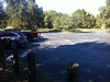
Landbridge Lot - 0.28 mi Ross Prairie Lot - 0.45 mi Santos Campground Loop - 0.48 mi Santos Campground Shortcut - 0.09 mi Santos Lot - 0.39 mi Points of Interest:
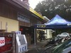
 Greenway Bicycles