| at: |
Santos |
Data from USFS GIS
 show on map
 animate
Trail users:


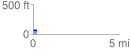
Elevation Profile
 0.235800 mi
 5.22 ft
 7.49 ft
 -2.27 ft
 0.60 %
GPX Downloads: Track Route
![]()
| at: |
Santos |
show on map
animate
0.235800 mi
5.22 ft
7.49 ft
-2.27 ft
0.60 %