| at: |
Santos |
Data from USFS GIS
 show on map
 animate
Trail users:


Elevation Profile
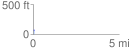
 0.050533 mi
 4.78 ft
 1.59 ft
 3.20 ft
 1.79 %
GPX Downloads: Track Route
![]()
| at: |
Santos |
show on map
animate
0.050533 mi
4.78 ft
1.59 ft
3.20 ft
1.79 %