| in: |
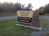
Chattahoochee National Forest - Conasauga Ranger District |
near: |
Chatsworth,
Georgia Ramhurst, Georgia |
 show on map
 printable map
Last Trail Update: 2017-04-10
printable map
Last Trail Update: 2017-04-10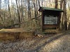
Hours:
24/7 except during organized hunts, use caution and courtesy during hunting season
Status Website:
http://www.fs.fed.us/conf/rec/ohv/rock-creek.shtml
Maps:
Links:
Rock Creek and Tatum Lead OHV Trails: Chattahoochee-Oconee National Forests, Georgia
Routes:
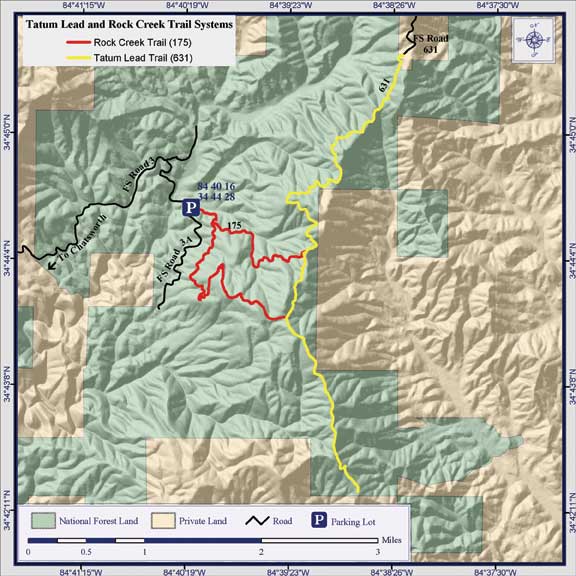
Mulberry Gap - P3, P4, P5 and Rock Creek - 23.55 mi
Rock Creek Loop - 5.14 mi
Trailheads:
 Pinhoti - Dennis Mill Parking LotRock Creek ORV Parking Lot
Total Mileage: (note)
 Hiking Trail - 0.36 mi Bike Trail - 3.89 mi Bike/Horse Trail - 3.13 mi Motor Vehicle/Bike Trail - 9.71 mi Dirt/Gravel Road - 11.45 mi
Trails:
Peeples Lake Trail - 0.36 mi Fort Mountain/Overlook Road Connector - 0.76 mi Overlook Road - 0.95 mi Pinhoti 5 - 2.19 mi Old FS3A (Doubletrack) - 0.61 mi Pinhot 6 Connector - 0.03 mi Pinhoti 6 - 2.48 mi Rock Creek ORV Trail (Northern Branch) - 1.35 mi Rock Creek ORV Trail (Southern Branch) - 2.67 mi Tatum Lead Road 4WD Trail - 5.69 mi | AKA: |
Old FS631 |
Roads:
Dennis Mill Parking Lot - 0.07 mi FS3 - 5.18 mi | AKA: |
Rock Creek Road FS10 Peeples Road |
FS3A - 2.05 mi FS3A (Grasstrack) - 3.21 mi Peeples Lake Parking Lot Road - 0.05 mi Rock Creek Parking Lot - 0.03 mi Tatum Lead Road - 0.86 mi | AKA: |
Old FS631 Tatum Mountain Road |
Dennis Mill Road - 2.60 mi Hwy 52 (Chatsworth to Ellijay) - 25.08 mi Old Federal Road - 6.16 mi Peeples Lake Road - 0.43 mi Points of Interest:
 Fort Mountain Lodge