| in: |
Chattahoochee National Forest - Conasauga Ranger District |
near: |
Blue Ridge,
Georgia |
 show on map
 printable map
Last Trail Update: 2012-12-11
printable map
Last Trail Update: 2012-12-11
Hours:
24/7 except during organized hunts, use caution and courtesy during hunting season
Routes:
South Fork Loop - 7.94 mi
Trailheads:
 Watson Gap
Total Mileage: (note)
 Hiking Trail - 6.06 mi Bike/Horse Trail - 3.80 mi Dirt/Gravel Road - 37.73 mi
Trails:
Benton MacKaye Trail (Dyer Gap to South Fork Trail) - 0.30 mi Benton MacKaye Trail (North of Watson Gap) - 3.58 mi Benton MacKaye Trail (South Fork Trail to Watson Gap) - 2.19 mi South Fork Pinhoti Singletrack - 1.10 mi South Fork Trail - 2.71 mi Roads:
Double Hogpen Road - 1.45 mi FS124 - 2.21 mi | AKA: |
Patterson Creek Road |
FS126 - 3.02 mi | AKA: |
Elliot Road |
FS22 - 9.18 mi FS22A - 2.48 mi | AKA: |
Sholey Creek Branch A |
FS22B - 1.15 mi | AKA: |
Ice Cove Road |
FS64 - 13.95 mi | AKA: |
Three Forks Road |
FS64B - 0.07 mi | AKA: |
Jacks River Field Road |
FS64C - 1.82 mi | AKA: |
Buddy Cove South Fork Pinhoti Roadbed |
FS64D - 1.44 mi | AKA: |
Dyer Mountain Branch D |
FS64E - 0.95 mi | AKA: |
Dyer Gap Road |
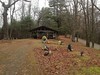
Points of Interest:
 Eastern Pinhoti TerminusDyer Cemetery